
We provide public leaders with innovative data and actionable insights for mission critical solutions anywhere you need to be.
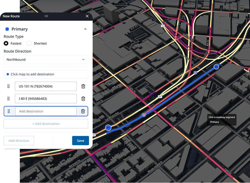
Route-level traffic insights, simplified
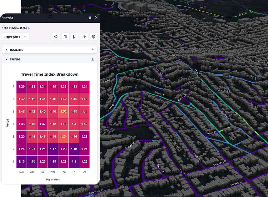
Spot time-driven patterns with ease
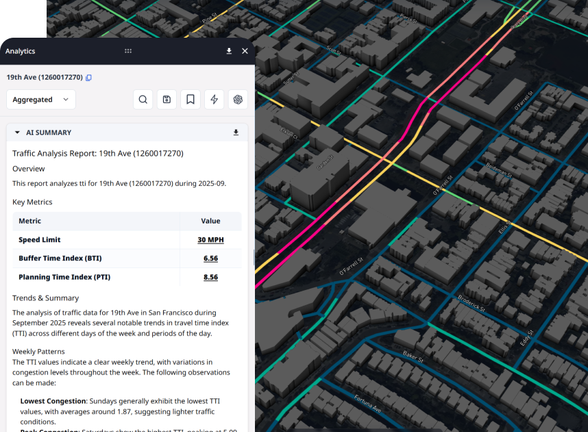
Use AI to turn complex data into clear Insights
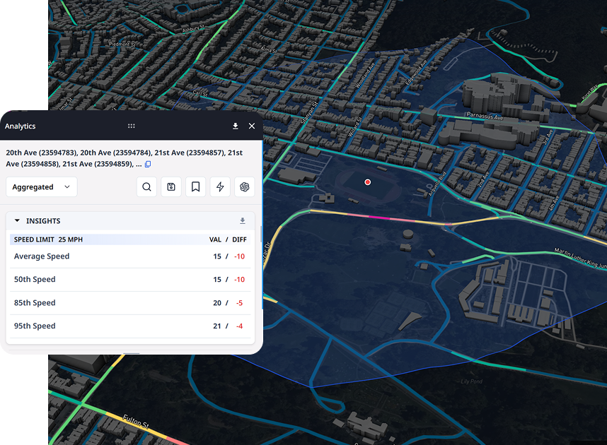
Sketch zones on the map for custom analytics
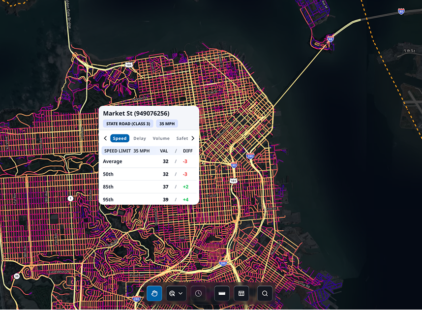
Hover for quick, on-the-fly snapshots
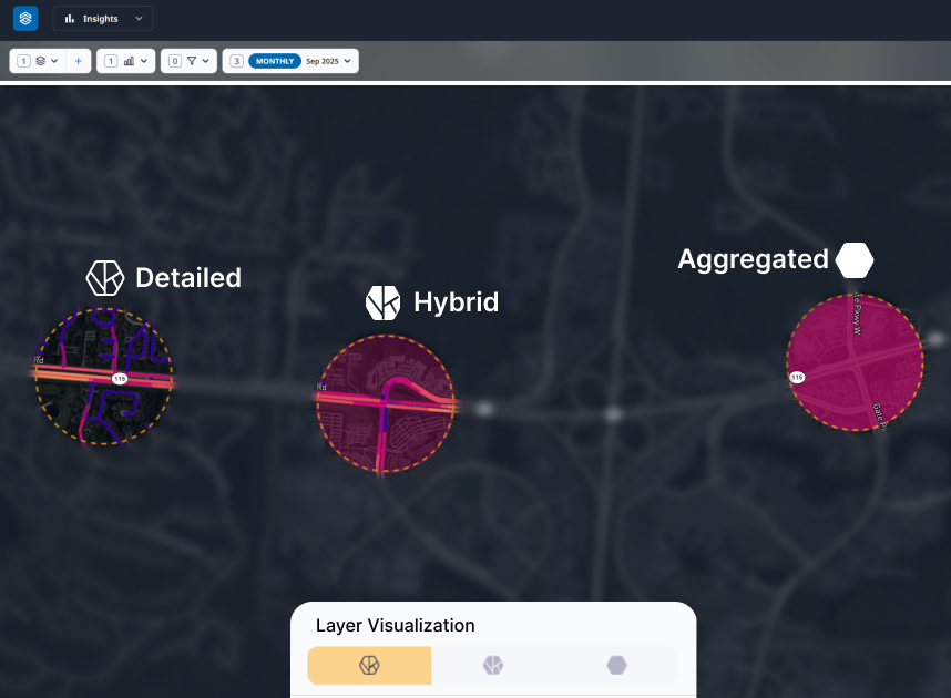
Toggle between detailed and aggregated views
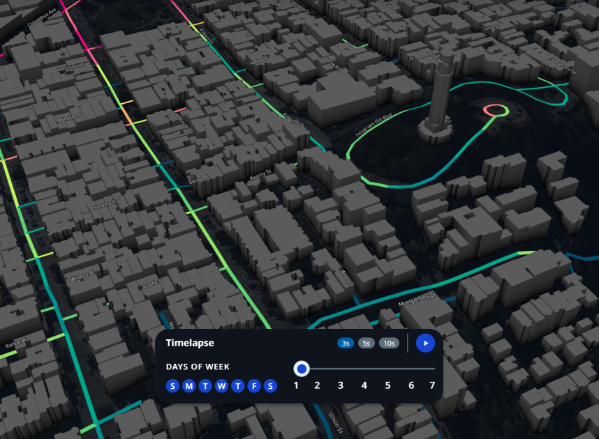
Scrub through time with dynamic timelapse
Trusted by 300+ Communities IN NORTH AMERICA


%203.png)


%203.png)
%203.png)
%202.png)
%203.png)
%202.png)

%203.png)


%202.png)


USE CASES
Automate daily tasks and
save hundreds of hours
Replace manual data collection, analysis and tasks with one simple platform.
FEATURES
Turning Data into
Actionable Intelligence
Hourly traffic data, analytics and AI tailored to help you prioritize issues, pinpoint trends and take action with fewer resources.
RETURN ON INVESTMENT
Join 300+ Communities in North America enabled by AI
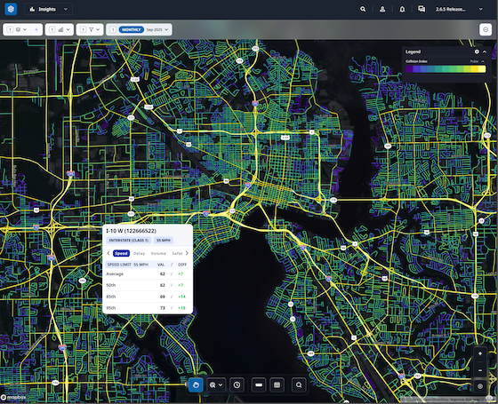
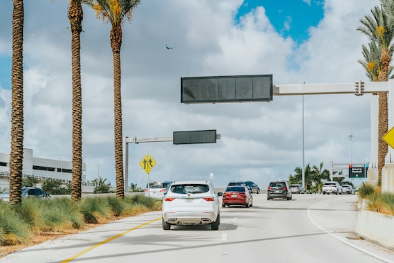
Urban SDK provides precise hourly speed data to evaluate complaints and deploy resources efficiently for the greatest impact to public safety.
Urban SDK provides precise hourly speed data to evaluate complaints and deploy resources efficiently for the greatest impact to public safety.

Save Time
Replace manual tasks, outsourced analysis, and expensive hardware with data and AI.

Improve Safety
Identify lurking traffic safety, infrastructure conditions, and natural disaster risks.

Respond Faster
Respond to citizen complaints and clear your backlog sooner with fewer resources.

Report Progress
Generate custom reports, share data, and automate public complaints task work in just a few clicks.
Customer success across
hundreds of cities
See how geospatial AI is empowering proactive public safety in large and small communities.
ROAD SAFETY
Hendry County Uses Urban SDK to Enhance Traffic Safety
Hendry joins 50+ Florida organizations utilizing Urban SDK's platform

traffic calming
Athens-Clarke County Enhances Traffic Calming Initiatives
The county joins a growing number of Georgia customers using Urban SDK's platform
traffic calming
Collision Index: Proactive Traffic Safety Powered by AI
The county joins a growing number of Georgia customers using Urban SDK's platform
Urban SDK Raises $65M Growth Round from Riverwood Capital to Scale AI-Powered System of Action for Local Governments, Transforming Public Safety and Service
Funding Accelerates Expansion of Geospatial AI Technology, Helping Cities Efficiently Respond to Critical Safety Concerns
ROAD SAFETY
Hendry County Uses Urban SDK to Enhance Traffic Safety
Hendry joins 50+ Florida organizations utilizing Urban SDK's platform
traffic calming
Athens-Clarke County Enhances Traffic Calming Initiatives
The county joins a growing number of Georgia customers using Urban SDK's platform
traffic calming
Collision Index: Proactive Traffic Safety Powered by AI
The county joins a growing number of Georgia customers using Urban SDK's platform
Traffic Volumes
Building Internal Traffic Analysis Capacity: A Roadmap for Reducing Consultant Reliance
Cities cut consultant reliance with mobility data to validate traffic calming, stop-control requests, and speed concerns using Urban SDK.
ROAD SAFETY
Hendry County Uses Urban SDK to Enhance Traffic Safety
Hendry joins 50+ Florida organizations utilizing Urban SDK's platform
traffic calming
Athens-Clarke County Enhances Traffic Calming Initiatives
The county joins a growing number of Georgia customers using Urban SDK's platform
traffic calming
Collision Index: Proactive Traffic Safety Powered by AI
The county joins a growing number of Georgia customers using Urban SDK's platform
Traffic Volumes
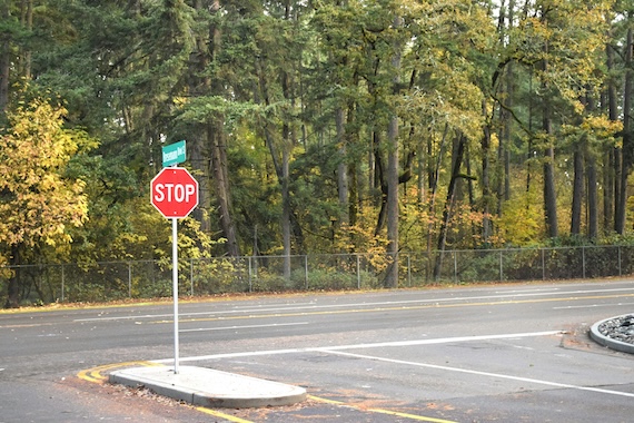
How Cities Can Use Traffic Volume Variability to Evaluate Stop-Control Warrants
Cities use traffic volume and continuous data to assess stop-control warrants, prioritize requests, and make decisions with Urban SDK.
WEBINAR
Identify speeding and proactively enforce issues
See just how quick and easy it is to identify speeding, address complaints, and deploy officers.
